When we talk about the climate crisis, we rarely think about the winds. We forget that moving air is the planet’s greatest fertilizer, the channel of the world’s largest river in the skies, the factor that determines the location of our houses, the apparent temperature of our cities and the existence of all beings on Earth. Today, like temperature, sea level and biodiversity, the winds are changing. A variation of a few miles per hour in wind speed can have consequences that completely transform our lives. How does a tiny droplet of water that originated in a remote spot in the Atlantic Ocean and was carried to the Caribbean by the wind affect an indigenous community in northern Colombia?
For Karim Ganem Maloof
About eight minutes before dawn on October 2, 2022, nuclear fusion in the center of the Sun radiated a beam of light that shot towards the Earth. At about six o’clock in the morning, after some of it was absorbed, reflected and dispersed by air, water vapor and various pollutants, the sunlight reached a remote spot in the Atlantic Ocean, about 1,200 miles (2,000 km) from Cape Verde. The temperature in the area began to rise and a tiny droplet of water —small enough that gravity did not pull it back —rose to the surface on a breeze.
Gradually, in swirls and gusts, the drop of water rose, carried by the wind. It exceeded 160 feet (50 meters), the usual limit at which seagulls fly during the day, rose above the tallest tree on the planet, reached the height of the Eiffel Tower and, around midday, the droplet reached 2,559 feet (780 meters) above the sea’s surface, barely fifty meters below the top of the Burj Khalifa hotel, the world’s tallest building.
As it rose, the trade winds, continuous currents created by evaporation in the tropics and the rotation of the Earth, pushed it in the direction of America, just as they had done 530 years ago with Columbus’ caravels. Between October 2 and 5, the tiny water droplet traveled nearly 1,000 miles (1,600 km). During the night and early hours of the following morning, the winds curved gently south over Roseau, the capital of Dominica, through relatively sunny skies. Propelled by increasingly brisk currents, the droplet from near Cape Verde, now slightly heavier but not yet heavy enough to fall back to the waves, headed southwest towards Venezuela and northern Colombia. The journey roughly resembled that made by trillions of microscopic water droplets every day at this time of year. followed a sort of familiar air channel, so to speak. However, there were some differences in the route and, in the United States and on the La Guajira peninsula in northern Colombia, some meteorologists were beginning to detect them, and had concerns.
Our trip was about chasing the wind
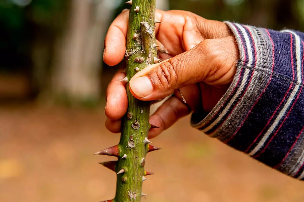
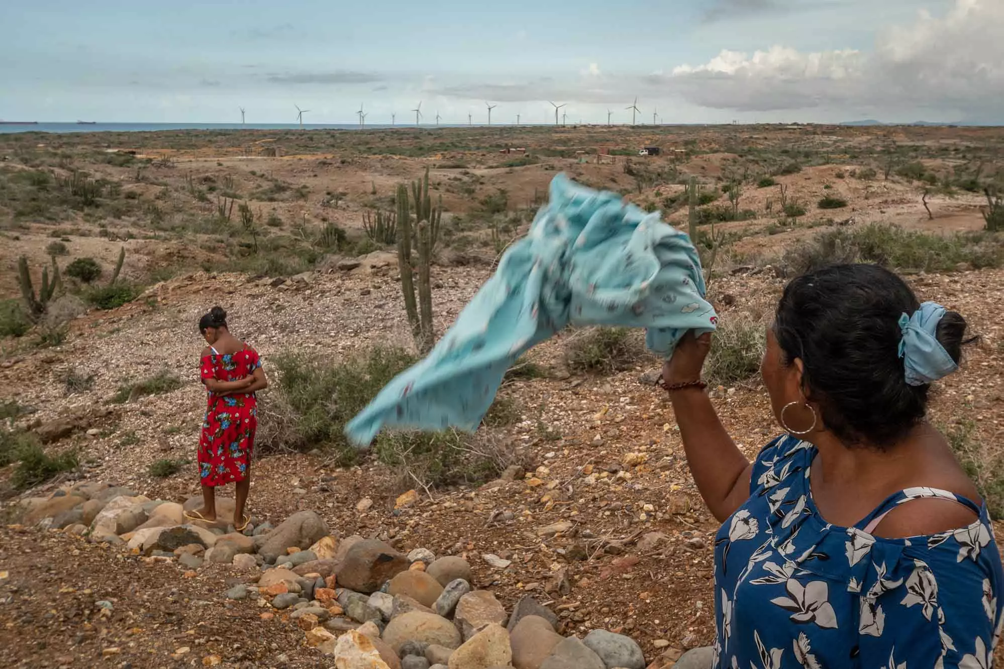
One afternoon in early October, I landed in La Guajira, an arid department on Colombia’s Caribbean coast, with photographer Sebastian Di Domenico. In Riohacha, the capital, gusts whipped up stinging swirls of sand all around us. Without warning, a squall sent my hat flying over the tapestry of shells that marked the border between water and land. On the horizon, ash clouds darkened the sky. Gulls, cormorants and pelicans soared upwards on vertical currents to get a better view of the water. On the horizon, ash clouds darkened the sky. On the boardwalk, a girl’s hair mimicked the swaying of the wind-swept palms framing the city behind her. As night approached, the tide devoured more and more of the beach and the waves broke with greater momentum. “Today we pulled out a 9-year-old boy who was drowning today,” a lifeguard told me as he walked away from his post. “He’s in the hospital. He’s in a bad way. The beach closes at 5pm.” Our trip was about chasing the wind: feeling it, touching it, smelling it, photographing it. If possible, that was where we would do it.
In 2000, Empresas Públicas de Medellín (EPM) and the Deutsche Gesellschaft für Internationale Zusammnarbeit (GIZ), a German state enterprise dedicated to international cooperation, installed two wind monitoring stations in La Guajira After analyzing the data for a year and a half, they concluded that the department was ideal for the exploitation of wind energy, with average wind speeds of around 9.8 meters per second throughout the year, almost twice the average of Chicago, the “windy city”. From that moment on, wind energy held the promise of development for the department, the fourth poorest in the country.
The president Gustavo Petro and his government are also betting heavily on wind in the energy transition. According to Belizza Janet Ruiz-Mendoza, the then deputy minister of Mines and Energy, if everything goes as the government hopes, by the end of their term, 5,000 GWh of energy will be produced, approximately 6% of the Colombian energy generation matrix, or enough to supply energy to a country like Nicaragua. This would replace almost 700,000 tons of carbon dioxide or the total emissions of four hundred and thirty seven thousand five hundred Colombians, according to their calculations. In January 2023, however, Ruiz resigned from office. Among her reasons for doing so, she cited hostility from Mines and Energy Minister Irene Vélez, the inclusion of false data in reports, and the selection of officials who did not meet the technical requirements required by law for boards of directors and other positions. At the end of June 2023, despite problems within the ministry, Petro upped the ante considerably. “Using just the clean energy from La Guajira at its maximum, we could replace all of Colombia’s electricity generation, including hydroelectric plants,” he stated, during the signing of a pact with indigenous communities authorizing the construction of a line to transport energy from the north of the country to its central regions. (In July, Irene Vélez, the portfolio minister charged with executing that vision, resigned amid an influence-peddling scandal involving her husband. Petro had evidently appointed her because of her close relationship with Vélez’s father. To replace her, the president appointed Andrés Camacho, an engineer and former skinhead, who, while applying for another government post, submitted a resume in which he claimed to have 22 years of work experience. Of this, he was only able to prove nine. Camacho blamed the misunderstanding on a “registry error”).
In his wind bible, Heaven’s Breath: A Natural History of the Wind, South African botanist, zoologist and anthropologist Lyall Watson estimates that approximately 2% of the sun’s energy received by the earth is converted into kinetic energy in the form of wind. This means that, at any one time, the energy produced by wind in the atmosphere would be enough to supply the entire world’s energy needs. The problem is that wind is distributed far and wide throughout the atmosphere, and it is not easy to capture it. Currently, wind and solar energy provide 10% of the world’s energy. Most countries are in a race to increase that percentage. (Wind-related schemes are not confined to the energy sector: a return to wind-driven ships has also been proposed to replace the emissions of the international shipping industry).
There are, however, several problematic assumptions behind this proposal, and the ambitious plans of presidents like Petro. On one hand, the track record of wind farm development in countries like Colombia has been plagued by cultural, bureaucratic and social difficulties. Implementation in Colombia has progressed languidly: today there are at least five dozen wind farms in the pipeline and two in operation. On the other hand, the wind —the driving force that for centuries has faithfully served agriculturalists, navigators, and aeronauts— seems to be changing, in large part due to the climate crisis.
‘I’m running low on optimism pills’
The wind is born of a dance guided by a star. The gusts we feel against our skin are the result of an endless game of chase between warm air and cold. When the sun’s rays heat the invisible mixture of gasses that make up a portion of the air, the molecules of these gasses begin to move faster and further away from each other. The gap between the molecules grows and that portion of air becomes less dense than the matter around it, so that, like a hot-air balloon, it rises. The opposite happens when a portion of air cools: the molecules move more slowly and stick together, and the portion of air descends, as it becomes denser and heavier. When a mass of air rises, the space it used to occupy is freed up. A low-pressure zone is then created, which the surrounding air seeks to occupy (gasses are fluids, as are liquids, and seek to fill this free space). This movement, which also exists in reverse when cold air descends and creates a zone of high pressure, is what we call wind.
The sun’s rays hit the planet at different angles because of the tilt and position of the earth. In places like Riohacha, in the tropics, the rays hit almost perpendicularly. The air is warmer than in the rest of the world, and expands and rises almost 15 kilometers above the surface. The opposite occurs at the poles at different times of the year. These differences in temperature, coupled with the planet’s rotation, are responsible for continuous global-scale air currents such as westerlies, trade winds and jet streams, which whirl around the planet in the upper atmosphere at hundreds of kilometers per hour.
For a couple of decades now, the pace of this solar-led dance has been slowing down. A number of scientific studies have detected changes in surface wind speeds —those measured at 10 meters above the ground —that cannot be attributed to cyclical variations or simple anomalies. In 1999 an analysis of nearly 30 years’ worth of data found an average decrease in these wind speeds. Studies in Australia, Asia, Europe and the United States yielded similar results. As a result, there was talk of a decrease in the average speed of about 10% worldwide (there were more worrying cases: in China, for example, the decrease was about 29%) and of a not entirely explainable phenomenon that was given the name of ‘global terrestrial stilling’. In 2021, northern Europe suffered a wind drought. According to one analysis, surface wind speeds in that part of the world decreased by an average of 15 per cent. This particularly impacted those countries that have made the most progress in the energy transition. This particularly impacted those countries that have made the most progress in the energy transition. To give just one example, in September 2020, 18% of the UK’s energy came from wind farms but in the same month of 2021, just 2% was supplied by this alternative energy source.
In Colombia, there are no major studies on changes in surface wind speeds, according to Yolanda González Hernández, director of the Instituto de Hidrología, Meteorología y Estudios Ambientales (IDEAM), the government agency in charge of monitoring, analyzing and helping to mitigate climate disasters. Even in La Guajira, whose future economy may well depend on wind, there is no data on the subject. Either way, the pattern is global: winds are changing, and there are indications that the phenomenon is not only occurring near the surface.
As with sea level and temperature —perhaps the most frequently mentioned consequences of the climate crisis— they are changing at rates that make it challenging to collect sufficient data. The UN’s Intergovernmental Panel on Climate Change (IPCC) calculated decreases and increases of about 10% in wind speeds in different parts of the world under the scenario of a 1.5°C increase over pre-industrial levels, which is already inevitable even in the short term. On the face of it, the variations are minimal. Or at least that would be the initial consolation. But if we believe that, it is simply because we have forgotten or do not know the extent of air movement on Earth.
“I’m running low on optimism pills,” Juan Fernando Salazar, a professor at the Environmental School of the Faculty of Engineering at the University of Antioquia, told me one afternoon in Medellín. “We’re altering the thermodynamics of the atmosphere,” he continued. “The slightest change can be very serious.”
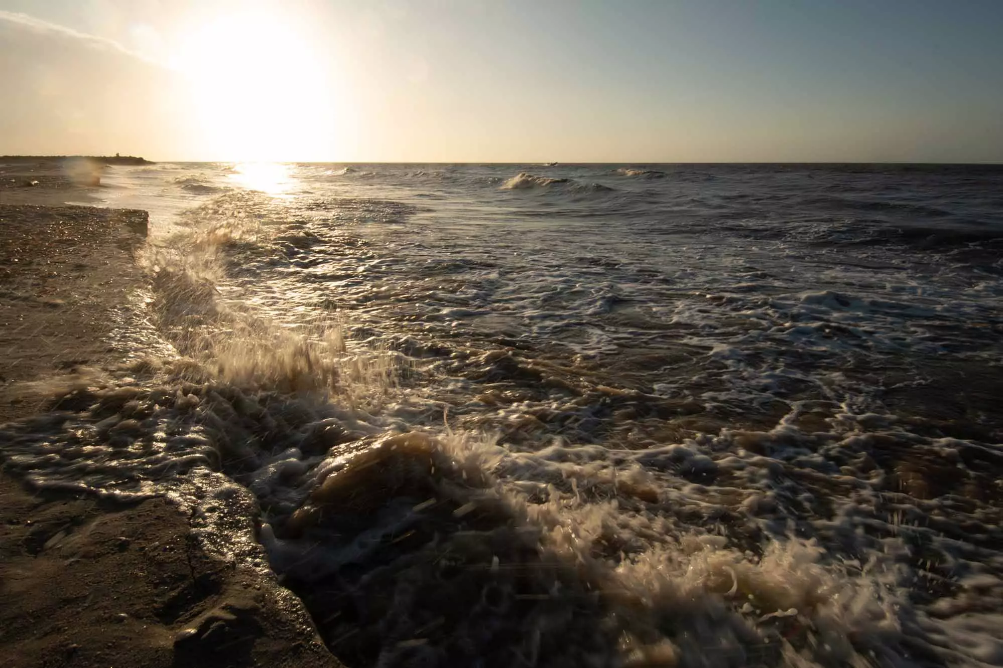
The start of hurricane Julia begins to generate powerful waves on the beaches of Riohacha, capital of the department of La Guajira
The substance of clouds
On the morning of 6 October, the tiny drop, which had formed four days earlier in the middle of the Atlantic Ocean, crossed the 65th meridian west on a current of air close to 2,625 feet (800 meters) above the water’s surface. As the temperature rose, it soared over the choppy Caribbean Sea.
Hours later, with the sun in the center of the sky, the droplet was between the Dominican Republic and the coast of Venezuela, off Maracay, spurred on by faster and faster gusts. Over time, it had increased in size, adding micrograms of weight. Despite this increase, it was still exceedingly light, and the winds kept it in the air without much effort (on average, a raindrop weighs 0.001 ounces (0.034 grams), less than the weight of an eyelash). Billions of similar drops, ‘the substance of clouds’ as Lyall Watson calls them, were moving alongside them in the direction of Colombia.
At around 11 a.m. that day, IDEAM issued a warning about a tropical wave in the Caribbean Sea off Venezuela. Institute staff identified an air mass with low pressure moving at 15 mph (25 km/h) towards the west. IDEAM has access to aroind 2,600 weather stations and several open-access satellites that track wind patterns around the world. For at least two days, the institute’s meteorologists had identified the low-pressure system and had been monitoring it carefully. According to the National Hurricane Center, a division of the US government in charge of monitoring tropical storms from a base at the University of Florida that is in constant contact with IDEAM, there was a high probability that the wave would become the thirteenth hurricane of the season.
Life on the planet depends and exists thanks to the winds
We are ruled by the wind. Its presence determines the weather every day, the way we dress and the lives of billions of beings, including humans. It affects the rains —they do not fall, the wind carries them— the location of our cities and settlements, the shapes of our houses, bridges and buildings; the reproduction of tens of thousands of species of fungi, ferns, mosses and algae; the survival of virtually all birds, flowers, seed plants, and spiders, insects, reptiles, mollusks and mammals that have learned to glide, soar on air currents or fly (I was once asked how birds fly: so, very briefly, wings accelerate masses of air downward and create enough force to counteract their weight and lift them up); crop yields, our apparent temperature and the flow of bacteria and viruses around the world; tides, air pollution and the migration of birds, dragonflies, butterflies and hundreds of animal and plant species; the shape of dunes, soil nutrients and the scale of natural and human disasters.
Life on the planet depends and exists thanks to the winds and their relative constancy, to that musical score directed by a star. Most cultures around the world have been aware of this and assigned one or several deities to represent it. The Sumerians had Enlil, lord of all winds; the Greeks had Zeus, god of thunder, storms and weather, and the Anemoi —Notus, Boreas, Eurus and Zephyrus—, the four wind gods associated with the cardinal points whom Aeolus held captive on his island, according to The Odyssey; the Tainos, in the Americas, had Jun Raqan, a god represented by a figure with a large head and arms that moved anticlockwise, the origin of the word hurricane; the Aztecs had Tezcatlipoca, the omnipresent night wind, and the Wayuu had Pulowi, a female deity associated with wind and droughts. There is also a close relationship between wind and the spirit. In Latin, spiritus is an inspiration or breath of a god; in Greek, pneuma means both spirit and wind; and in Arabic and Hebrew, ruh is wind and breath.
“The breath of the universe is called wind,” the Chinese philosopher Chuang Tzu wrote.
“The wind is us – it gathers and remembers all our voices, then sends them talking and telling through the leaves and the field,” Truman Capote wrote.
When, in 1833 near Tierra del Fuego, a migration of millions of butterflies surrounded him on the Beagle, Darwin noted: “vast numbers of butterflies [were flying], in bands or flocks of countless myriads, extended as far as the eye could range. Even by the aid of a glass it was not possible to see a space free from butterflies. The seamen cried out ‘it was snowing butterflies’, and such in fact was the appearance.”
“Without wind, most of Earth would be uninhabitable,” Lyall Watson writes, in Heaven’s Breath.
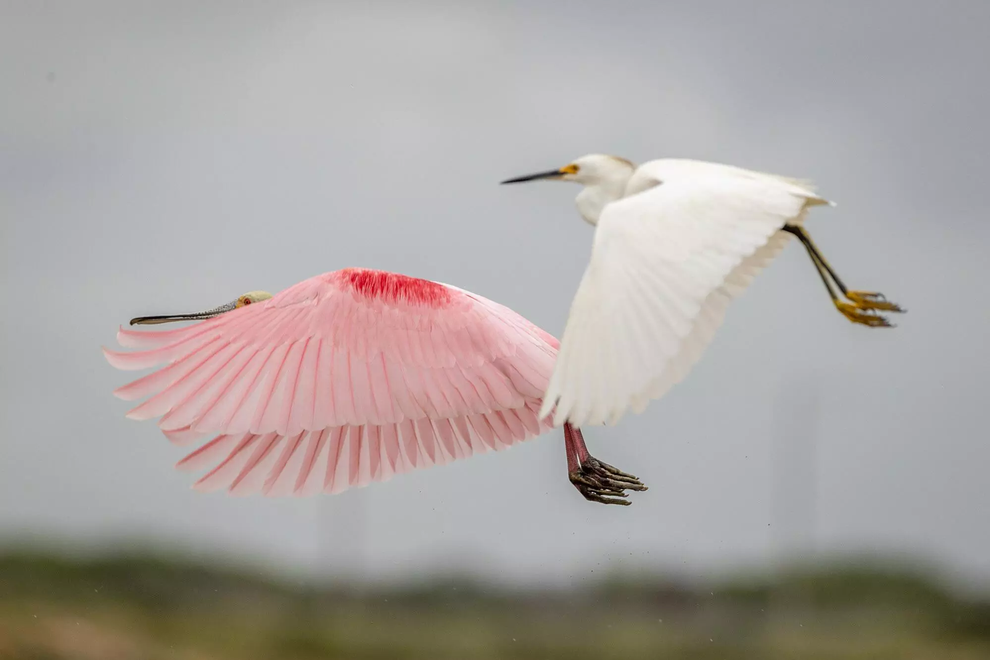
Spoonbill and white heron taking off near the seashore in search of food
The wind is the greatest fertilizer on the planet: it moves each of the 1,000 million grains of pollen that annually cover every square meter of the world. It connects the North Pole with the Caribbean, Patagonia with Australia and North Africa with Europe and South America. Wind currents carrying the reddish sand of the Sahara have caused blood-colored rains in European countries. Homer and Virgil mention them. In 1859, a crimson snow covered thousands of square kilometers in Germany. Phosphorus from the red sand of the Sahara fertilizes and gives life to the Amazon.
There’s a saying, “There is no water without wind.” All the world’s rivers flow into the sea, due to the Earth’s gravitational pull. On average, they deposit approximately 40,000 km3 of water per year, enough to cover the entire land surface of South America with more than two meters of water. The atmosphere replenishes this water in the form of rain — if this did not happen, the rivers would dry up and does so through water-laden wind currents sometimes called aerial rivers or flying rivers (José Marengo, a Peruvian meteorologist and contributor to the IPCC, coined the term at least 15 years ago). These rivers are fed by the evaporation of water caused by the sun and by the transpiration of plants, another equally important phenomenon. Just as we perspire, trees also transpire. In the Amazon, a healthy 65-foot (20-meter) tall tree can release 265 gallons (1,000 liters) of water into the air each day through transpiration. That water rises as steam and feeds the flying river that runs above it, which in turn will feed the river and the trees on the ground.
These days, it is possible to calculate the trajectory of rain that has fallen at a specific point in the world by means of satellite images (the calculations for this story are courtesy of Dr. Rubén Molina, researcher at SOS-Cuenca). The retro-trajectories show the significance of aerial rivers and the dangers associated with their changes. Rain in a city such as Medellín, is water that could have been in the Antilles or in Manaus a week earlier.
Forests are forests, plains are plains and deserts are deserts… because of the wind. An increase or decrease of a couple of kilometers in its speed can alter an ecosystem, create a new landscape and dictate whether we survive a heat wave, whether we hear a call for help, whether we smell the gas stove that the neighbor forgot to turn off, whether rain falls on our heads and whether a tropical storm becomes a hurricane.
The improvements promised by wind
As the tiny water droplet that originated in the vicinity of Cabo Verde gained speed as it passed through La Guajira, Sebastian Di Domenico and I set off from Riohacha to Cabo de la Vela, a small seaside resort town known for its beaches, food and kitesurfing. Not far from there are the only two operating wind farms in Colombia.
Beneath a cloudy sky, we drove along a road flanked by hawthorns, tin-bladed windmills and irrigation ditches overflowing with water until we reached Uribia, an ochre city of unpaved streets known as the indigenous capital of Colombia, as it has the largest native population in the country. 98% of its nearly one hundred and ninety thousand inhabitants belong to the Wayuu, an indigenous people who live mostly by herding and trade, on Colombia’s La Guajira peninsula and in the state of Zulia in northwestern Venezuela.
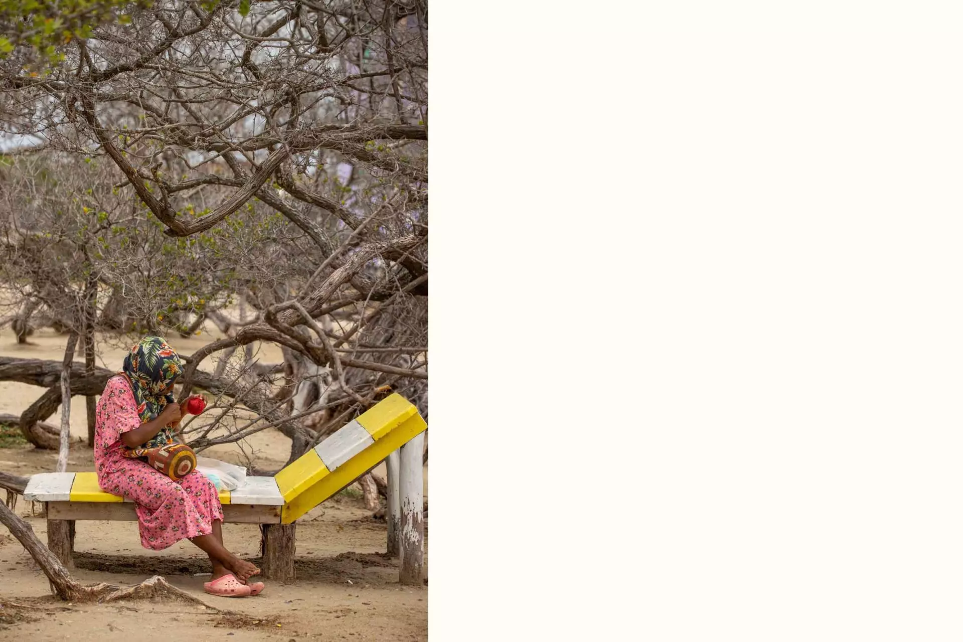
Wayuú woman weaving handicrafts in Uribia, the indigenous capital of Colombia
We had a breakfast of arepas and a mixture of goat, beef and sheep stew (the iguana we passed up), and later met with Edgar Paz González, authority of a traditional Wourre community of the Wayuu people, and Hernán Gómez, undersecretary of Mines and Energy of the municipality between 2021 and 2022, to talk about the history of wind farms in the region. Paz met us at his home on the outskirts of town shortly before the second the heavens opened with the second downpour of the day.
Since 2015, the Wourre community has been negotiating with a company called Begonia Power, now owned by Celsia, part of Grupo Argos, one of the country’s largest conglomerates. Begonia plans to install 16 wind turbines —huge, slender, three-bladed windmills that can transform wind energy into electricity— and two transmission lines in a territory belonging to the Wourre community and two other Wayuu communities just over an hour south of Uribia. “As soon as we are born, it’s a psychological adaptation,” Paz told us about the wind in that area. “Here it’s hot. Over there you lie in a hammock and a breeze blows.”
The problems involved in the construction of the park, named Acacia 2, are emblematic of the region. In principle, Acacia 2 represents an important opportunity for these communities, as they lack schools, housing materials, energy, aqueducts, or constant access to drinking water (they often have to bring water trucks from nearby cities). In exchange for building in their territory, the company must compensate them with improvements in their quality of life: i.e. schools, housing, reservoirs or wells, among others, and with support to set up productive projects —think handicrafts, livestock, crops, and so on—.
The issue, of course, is not so simple. In order to build wind farms, companies must comply with a number of legal conditions, including environmental impact studies, bureaucratic issues and previous consultation. The latter is a fundamental right that ethnic and indigenous groups have when making decisions about projects that may affect the community. In the case of Acacia 2, there were three different communities at the site chosen for the construction of the park. The company chose to negotiate individually and hold prior consultations with each of them, despite the fact that at the beginning there was a united front, according to Edgar Paz. In his case, the wind farm will occupy half of their land, specifically the grazing area of their cows, goats and sheep, their main livelihood. “We accepted these projects out of an eagerness to improve on what we lack, and fully aware that there would be significant negative impacts for us,” Paz told me that morning in Uribia. “To us, they are priceless.”
The environmental license for Acacia 2 Park was approved in 2016. According to engineers, the physical infrastructure construction could take one to two years, but, although there have been numerous meetings between the community and the company, a definitive agreement on compensation has not yet been reached. The Ministry of the Interior and the Maicao mayor’s office are supposed to accompany the talks, but only the former have been there, according to Paz. And until they reach an agreement, neither the construction of the park nor the school or the other improvements promised by wind will be able to begin.
Like Acacia 2, most wind projects in La Guajira are advancing slower than planned, according to Hernán Gómez, former secretary of Mines and Energy in Uribia. Between 2018 and 2022, the President Iván Duque’s government promoted almost a dozen projects. Alpha and Beta, the largest, will have 50 wind turbines capable of producing 504 MW, enough energy to supply 2.5 million Colombians. They should have been operational months ago, Gómez told me when we met at the mayor’s office. The local government is trying to follow up on the negotiations, but there are not enough resources to do so. There are 3,500 communities registered for more than 50 wind farms, according to Gómez. The mayor’s office was receiving five or six invitations a day for prior consultations, but there was not enough financial capacity or personnel, he concluded before we said goodbye.
At noon, we took the only road leading from Uribia to Cabo de la Vela. Torrential rain from the east turned the road to coppery mud. Outside the cab of the 4×4 truck, capricious gale force winds changed the direction of the rain from one moment to the next. The jagged drops shook the boundary fences and mud walls of the Wayuu ranches we passed along the way.
The wind had blown most of the clouds out to sea by the time, two hours later, we spotted the first wind turbines on the horizon. They looked like tall, slender giants gesturing in the empty fields. We stopped in the middle of the road, which ran parallel to the train tracks of Cerrejón, the world’s largest open-pit coal mine. In front of us, the three blades of the wind turbines of the Guajira I wind farm, inaugurated earlier in the year, were turning, turning, turning. Behind them, to the northeast, fifteen slightly smaller wind turbines from the Jepírachi wind farm performed the same choreography.
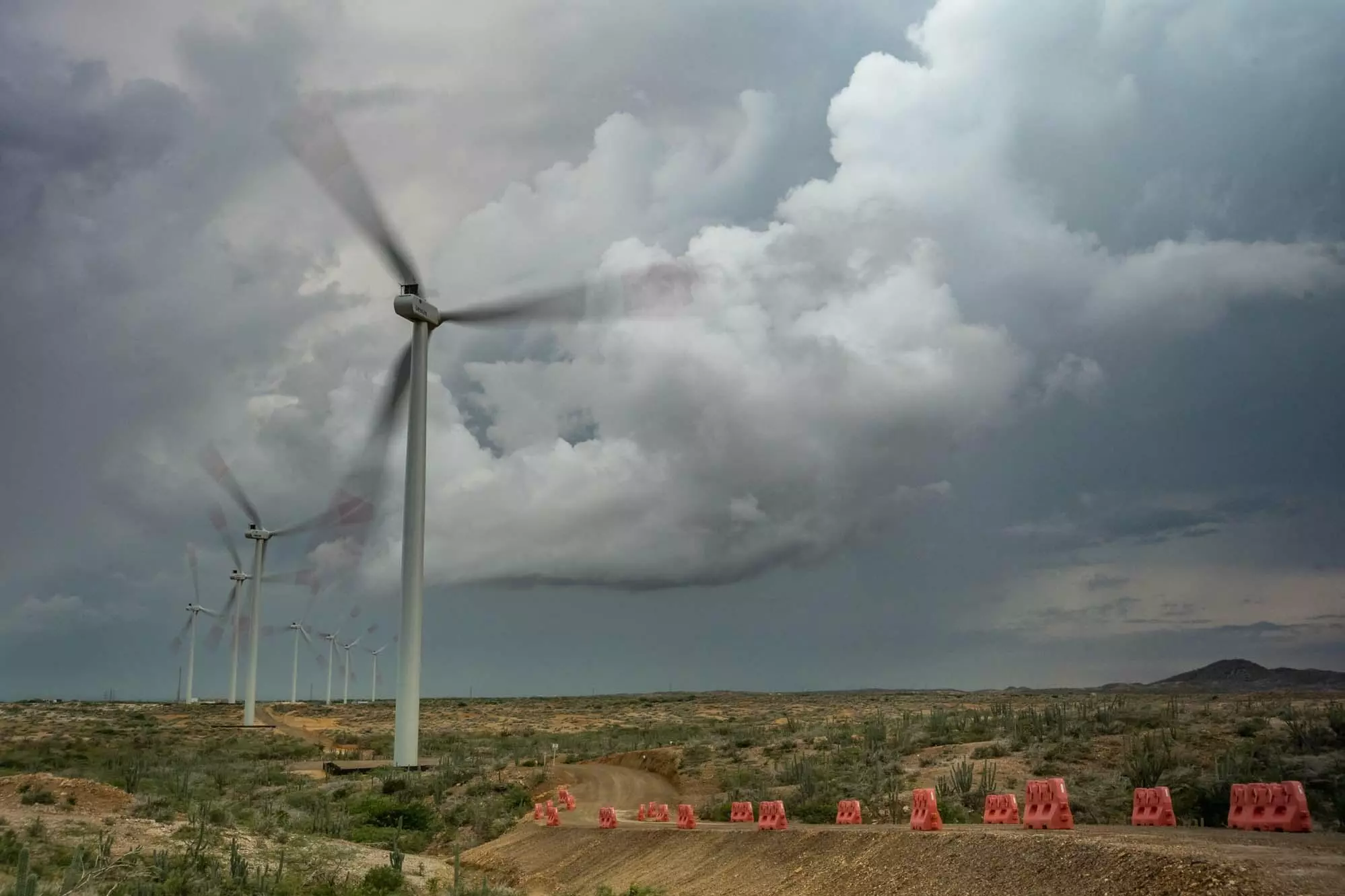
Jepírachi wind farm, built on Wayuú land, was the first wind farm in Colombia to come into operation
Jepírachi —winds that come from the northeast, in Wayuunaiki, the Wayuu language— was the first wind farm to come into operation in the country. It began operating in 2004, after EPM built it at lightning speed. The 15 wind turbines —Nordex N60, total effective capacity of 18.42 MW, enough energy to supply 9,800 Colombian homes— were erected on land belonging to the Wayuu. According to research by the Instituto de Estudios para el Desarrollo y la Paz (Indepaz), a Colombian NGO, the model was a disaster. There was limited consultation with the community and a lack of transparency about the payments they would receive or the improvements that would be made. EPM assumed that the community was “incapable of managing money or accounts” and retained “control over payments or expenses in kind and by project,” according to Indepaz. (According to EPM, “there was a broad and successful process of prior consultation“ with the Wayuu living in the zone of influence of Jepírachi).
The wind farm was originally due to cease operations in 2023, as its license was not renewed. The wind turbines were to be replaced by taller, more modern ones, but, according to the government, this could jeopardize flights arriving at the Cerrejón mine airport, some three miles (five kilometers) away. However, in July 2023, the then Mines and Energy Minister Irene Vélez announced that EPM would hand over the park to the Wayuu communities to operate as part of a public-private partnership. The information took even some of the communities that would become owners of Jepírachi by surprise, as reported by the newspaper El Espectador.
It was drizzling slightly as we crossed the train tracks and headed for Guajira I —20 MW of effective capacity; about 10,600 homes—. The project began operating in early 2022 after more than a decade of studies and negotiations with the Wayuu. Isagen, a former Colombian public company now owned by a Canadian fund, invested 75 billion pesos (about US$18 million at the time) into its construction. President Iván Duque personally went to inaugurate it. Days before the photo, the four Wayuu communities had gone on strike and blocked access roads to protest against the wind complex. (The protests have not subsided with the arrival of the Petro government: in May 2023, the Enel Group, a multinational energy company, suspended the construction of Windpeshi, a 205 MW wind project, sufficient to power 500,000 homes, after failing to reach an agreement with the communities in the area).
We stopped underneath a wind turbine to take pictures. The sound of the blades was reminiscent of air whooshing in and out of a cave, or a hand dryer in the distance. They were turning at 9½ revolutions per minute. A group of soldiers in desert camouflage approached us to ask who we were. They had been patrolling the area for several weeks. They told us they get along well with the communities, but that the communities sometimes have problems with the companies.
We carried on down the road to another group of wind turbines. A herd of goats were ambling around near the base. Nearby, three Wayuu women sat on a hill keeping watch over them. Their brightly colored clothes danced in the gusts of wind. The hissing of the masts drowned out the occasional murmur of the breezes coming in off the sea.
“Ever since they went into operation, I dream about water all the time,” said Elba Velázquez, a 54-year-old Wayuu woman who lives in one of the communities where the park was built. “It sounds like a stream of water, don’t you think? At first, they put wire on the blades to keep the birds away and it sounded like footsteps in the night,” she added, slightly peeved.
Wayuú families suffer the inconvenience that the wind farm has brought to the region. The noise from the wind turbines makes it hard to sleep
Generally speaking the communities are not happy with the park. Some people were unemployed, Elba’s granddaughter, Karolay Patricia Berrier, aged 15, told us. As part of the negotiations, the company had been asked to put local people in charge of guarding the park, this giving members of the communities permanent, well-paid jobs: a rarity in the area. But Isagen was considering dispensing with the guards and simply putting cameras on the wind turbines.
Furthermore, the communities feel that they are not receiving the benefits of the wind. Under Colombian law, 1% of net sales must be distributed between the authorities of the municipality where the project is located (0.4%) and the community (0.6%). This is in addition to compensation and improvements. So far, Elba’s community has received 30 million pesos (about US$6,000), nine houses in materials and an improved reservoir. But many people had to move and now have to live with the constant noise of the wind turbines. In other words, the company seems to be taking the lion’s share of the benefits, when the deal should be an equitable one.
“There were seven years of meetings, but we only learned the reality of what was promised much later,” Elba told me. “They don’t want us to talk, to say anything,” she continued, using a turquoise scarf to shoo away the mosquitoes which took advantage of lulls in the wind.
It had started to drizzle again and Karolay beckoned to hear grandmother for them to leave. Before they left, she looked out to the ocean. A ship loaded with coal had anchored off the coast. On the Venezuelan side, to the northeast, a front of black clouds was rapidly rolling in.
Storms, gales and hurricanes
The difference between a tropical storm and a hurricane is 0.6 mph (1 km/h) in wind speed. If the sustained gust speed ranges from 39 to 73 mph (63 to 118 km/h), it is classified as a storm. If the speed exceeds 74 mph (119 km/h), it is a hurricane. From then on, the speeds determine its category (the highest is category 5 with speeds above 157 mph (252 km/h); the world’s fastest wind other than a tornado or hurricane was measured on April 12, 1934 at the top of Mount Washington in the United States: 231 mph (341 km/h).
In the Atlantic, a hurricane lasts for approximately nine days and can travel thousands of miles. Wind speeds do not reach those of a tornado, but gusts are more sustained and last longer. Its waves can reach 82 feet (25 meters high) and, according to the book Tropical Meteorology, on average, it discharges 20,000 million tons of water per day, an amount of energy equivalent to half a million atomic bombs.
The destructive power of hurricanes is difficult to compare. A hurricane that swept through Bangladesh in 1970 left between three hundred thousand and five hundred thousand people dead, more than twice the number killed in Hiroshima. Almost a century earlier, in 1881, in Vietnam, a typhoon —from the Cantonese daai fung, meaning ‘great wind’, the Asian name for such storms— killed nearly three hundred thousand people. In 1737, another one in India left at least two hundred thousand people dead and sank, according to chroniclers of the time, around twenty thousand ships. In 1772, in Cuba, a storm that became known as the Great Hurricane caused the death of twenty thousand people, according to the book Divine Wind: The History and Science of Hurricanes, by the American meteorologist Kerry Emanuel.
The material damage is equally devastating. In 2005, in the United States, Hurricane Katrina, the most destructive hurricane in history, left losses equivalent to $195.2 billion in 2022 dollars, 40% of total U.S. welfare spending. In 2017, Hurricane Maria destroyed 80% of crops, bankrupted the company that provided the island’s power, and set back Puerto Ricans’ potential economic recovery by more than a decade. In total, the cost of the three most damaging hurricanes in the United States is greater than the sum of the gross domestic products of Uruguay, Bolivia, Paraguay and Chile. (“Wild Spirit, which art moving everywhere; Destroyer and preserver; hear, oh hear!” Percy Bysshe Shelley wrote in his poem ‘Ode to the West Wind’).
In her book, Natural Disasters in Latin America and the Caribbean, U.S. journalist June Carolyn Erlick shows how these phenomena have physically and mentally shaped the Caribbean. In Cuba, the hurricanes of the nineteenth century changed the island’s agricultural production, according to historian Louis A. Pérez Jr., Cuba went from growing coffee, bananas and other crops to relying primarily on sugar cane, due to the havoc wreaked by the storms. “Like slavery, race, immigration or imperialism, hurricanes have defined the region,” writes Stuart B. Schwartz, professor of history at Yale University.
Historically, Colombia has not been one of the countries most affected by hurricanes. For this reason, perhaps, we do not fear the ocean as much nor do we have the same respect for it as countries such as the Dominican Republic, the United States or Cuba. In the last 100 years, only 15 major storms have hit Colombia’s continental coasts. In the same period, the archipelago of San Andrés, Providencia and Santa Catalina, one of the country’s main tourist destinations, was hit by eight storms that caused significant damage.
The most recent occurred in November 2020, in the midst of the pandemic. Between November 15 and 16, winds of more than 145 mph (233 km/h) from Hurricane Iota —since World War II they have been named in alphabetical order; previously they were just randomly assigned women’s names— killed four people in the archipelago, disrupted 98% of San Andrés’ infrastructure and destroyed 1,134 homes in Providencia (the island has a little more than five thousand inhabitants). The government allocated 1.2 billion pesos for reconstruction, about $400 million at the time, or about three times Colombia’s annual budget for science and technology. (It is not clear what happened to part of those resources or what percentage of the costs of such disasters should be shouldered by other countries).
Iota, a category 4 hurricane, was traumatic for the islands and the country. The issue of rebuilding dominated the news cycle for months and prompted donation drives throughout Colombia. Iota changed the way Colombians thought about storms. For nearly 30 years, hurricanes were events that happened elsewhere —Joan, the last Category 1 or higher to hit the archipelago, occurred in 1988—. Like tornadoes, tsunamis and snowstorms, they were foreign weather events, tragic curiosities/occurrences or something that other nations had to deal with.
What happened in the archipelago of San Andrés, Providencia and Santa Catalina turned that perception upside down. In September, Javier Pava Sánchez, director of the National Unit for Disaster Risk Management, openly admitted as such. Colombia is not prepared for these storms and everything indicates that they will become more frequent. If the temperature rises, in principle, hurricanes will have more fuel at their disposal, since there would be a greater availability of warm and humid air to feed and increase their intensity. IPCC models and several studies show those exact projections. As such, millions of Colombians, as if they were seafarers, will again have to monitor daily —often fearfully— the direction and movement of the air.
The wave reached tropical storm status: Julia
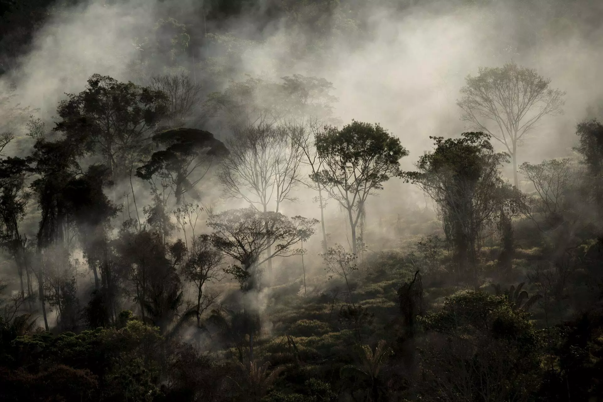
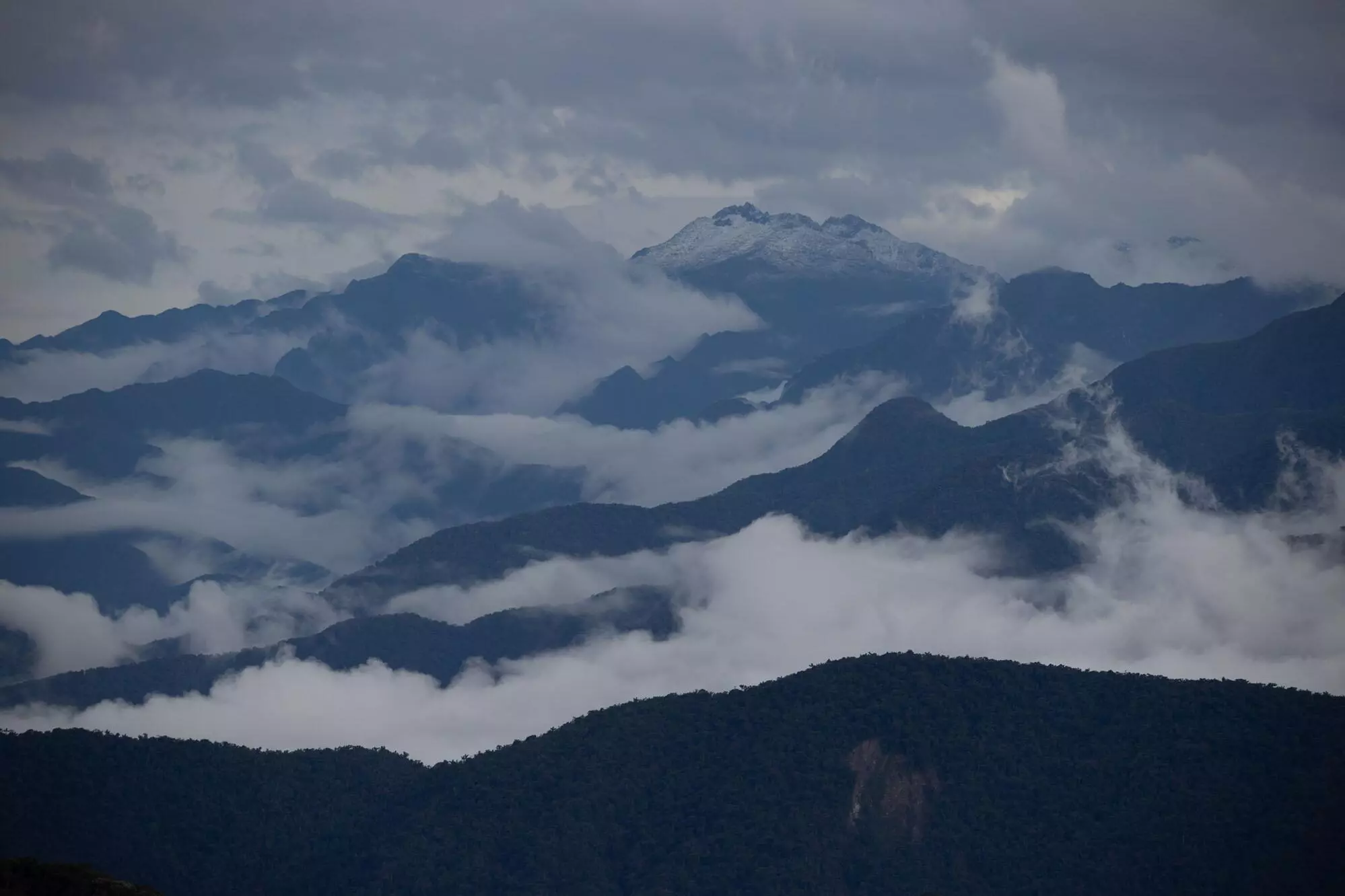
At 11 a.m. on October 7, after leaving La Guajira behind, we stopped at a restaurant near Minca, the closest town to El Dorado, a natural bird watching reserve located in the foothills of the Sierra Nevada de Santa Marta. The Sierra, a mountain range with snow-capped peaks of over 18,700 feet (5,700 meters) that are 25 miles (40 km) from the sea, is a geographic oddity that profoundly affects the region’s climate and winds. And the El Dorado reserve, located about 7,874 feet (2,400 meters) above sea level, provided a prime vantage point.
Subconsciously, we are following the route of the water droplet. That morning, the wave identified the previous day by IDEAM in the Venezuelan Caribbean reached tropical storm status. In the morning, the system reached the Colombian coast and received its first name: Julia. At 10:20 a.m., from Providencia, Yolanda González Hernández, director of IDEAM, announced that conditions were conducive for it to become a hurricane. At 11 a.m., in conjunction with the National Hurricane Center, the institute declared a state of ‘maximum alert’ for the archipelago of San Andrés and Providencia.
According to projections, the eye of the storm would pass in front of the Sierra Nevada de Santa Marta around 1pm. Like all large mountains, the Sierra has atmospheric circulation systems of its own, which we had planned to observe from the heights of El Dorado long before Julia was born in the Atlantic. Now we had a chance to see it from up high.
At the restaurant, the windstorms came one after the other. Down in the valley, the trees were bending and the moths were being blasted into the sky in mid-flight. The rain pounded sideways against the car windows. As we sipped our hot drinks, a gust of wind lifted a tin roof tile and tossed it into the abyss. Occasionally, a whirlwind made the leaves, torn from the bamboo, dance. The wind carried dust, seeds and menus showing the prices of aguapanelas, ribs and meats (in Dutch the word uitwaaien means something like standing facing the wind to cleanse oneself physically and spiritually). I zipped up my jacket and stuffed my hands in my pockets. Two dogs scampered past us while another one shivered as it tried to shelter from the flurries of the storm. I was shivering too, agitated, as I cradled a cup of steaming aguapanela in my hands.
In the Atlantic, a hurricane lasts for approximately nine days and can travel thousands of miles
The apparent temperature, as people who live with winds know very well, does not depend exclusively on the ambient temperature. There is a thin layer of air in permanent contact with our skin that functions as a sort of blanket. When the air warms up —because of our temperature, the sun or any other reason— it rises, and cooler air replaces it. This cycle stops —and we feel comfortable— as soon as the air layer approaches body temperature. Wind accelerates the process of replacing the blanket and reduces its thickness. The fur of dogs and other animals protects that wind blanket. In 1941, the fashion industry analyzed the amount of clothing a person should wear to be comfortable and not feel cold in an enclosed room with 50% humidity and 21°C temperature. At the time, it was determined that a man wearing a three-piece suit could maintain a constant body temperature under those conditions. That insulation became the international measurement in the textile industry and represents a value of 1 Clo (a bikini has a Clo value of 0.04; a T-shirt, 0.10; a V-sweater, 0.37; a down fleece suit, 3.5; a husky dog, unclothed, 4.1; a wolf, 7.5; and a polar bear 8). Those kinds of measurements are used to measure the amount of insulation needed to live comfortably anywhere. It depends largely on the wind, which thus also determines the way people dress. In the winter of 1814, one of the coldest in English history, James Woodforde, an English parson who penned The Diary of a Country Parson, a remarkable account of British country life in the nineteenth century, summed it up as follows: “it took the aid of the north wind to enforce the return to modesty in women’s dress.”
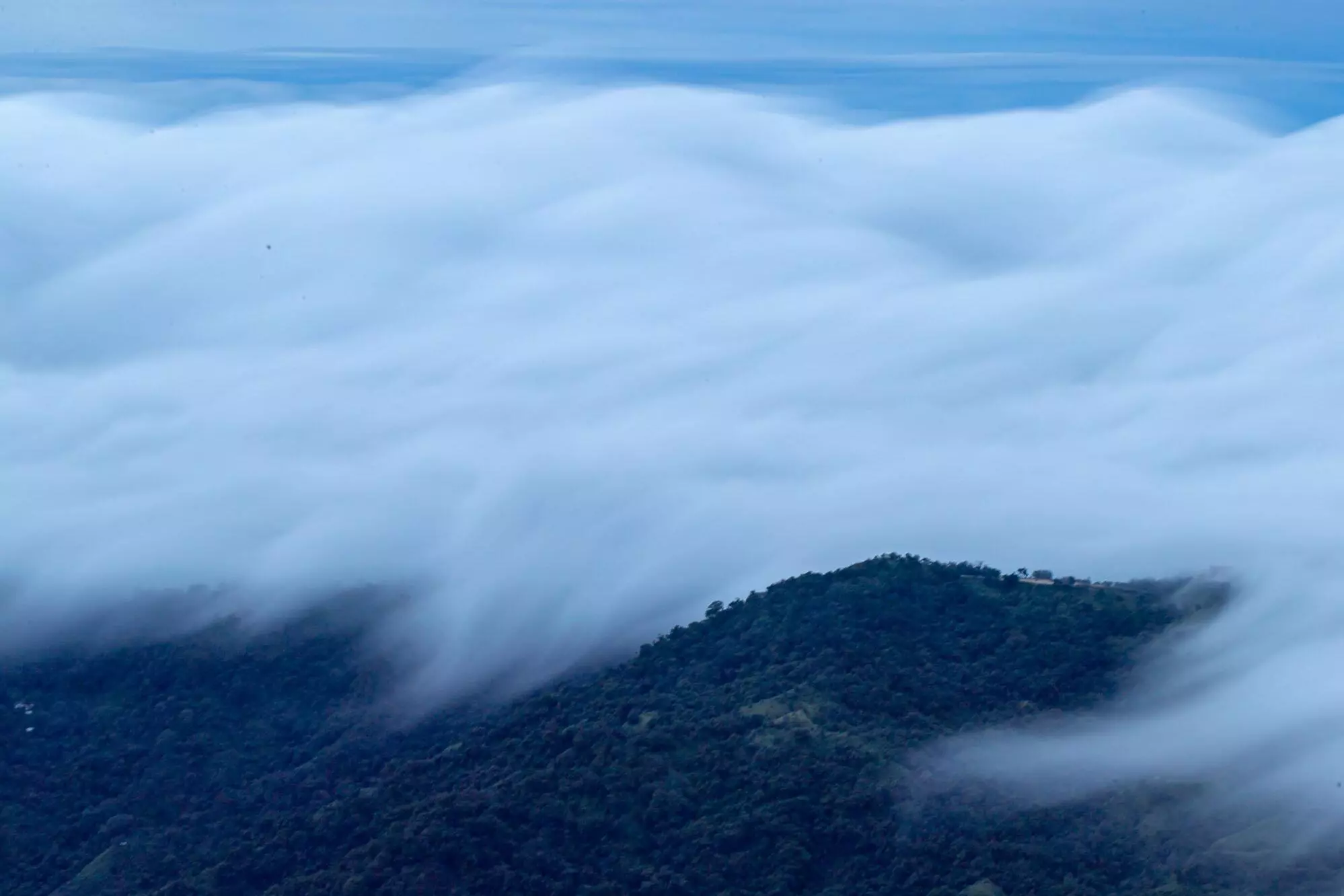
In the Sierra, lacking proper insulation, we grabbed a very quick lunch, at a table exposed to the gales, and then continued our ascent. We reached El Dorado around 2 pm. A mist as thick as custard covered the mountains, Santa Marta, the Ciénaga and the peaks. We left our bags in a round, thatched-roof room, inspired by the houses of the Kogui Indians, the main inhabitants of the Sierra for centuries. We went upstairs to the restaurant, a similar construction, but larger, with glass instead of walls and a surrounding balcony with chairs to sit and watch the scenery. Samanta Archila, a 23-year-old forestry engineer from Bogota who had been managing El Dorado for a few months, met us at the entrance. Samanta Archila, a 23-year-old forestry engineer from Bogota who had been managing El Dorado for a few months, met us at the entrance. On clear days, she told us, from this spot you can see the snow-capped peaks, seven valleys, the Zona Bananera in the interior of the country, the Ciénaga Grande, Santa Marta, Barranquilla and the Caribbean Sea merged with the sky.
That day we could see nothing. A freezing drizzle caressed the observation deck, with the wind howling past every now and then. “It’s because of the cyclone,” Samantha told us, pointing to where the ocean should be. As the storm lashed the coast, clouds covered everything. Inside one of them, some 25 or 30 miles (40 or 50 km_ from the balcony where we were, the tiny drop of water from the Atlantic, near Cape Verde, was galloping in aerial streams being whipped along by Julia.
Julia turned into a hurricane
In the early morning of October 8, the buffeting of the wind woke me up unexpectedly. It was still dark, but from the room I could see the lights of the city of Santa Marta, some 7,875 feet (2,400 meters) below. That day, dawn broke at 5:25 am. The sky was completely clear. Visibility was at least 75 mph (120 km). The sun climbed slowly, tinting the mountains blue. From the nearest valley, the wind roared like howler monkeys, or howler monkeys roared like the wind.
At midday, at about 2560 feet (780 meters) above sea level off Cartagena, the tiny drop of water born in the middle of the Atlantic abruptly changed direction. During the night of the 7th and early morning of the 8th it had stuck to the coastline. But hours later, the pull exerted by the low-pressure zone in the center of Julia was inescapable.
During the afternoon, the wind current in which the drop was traveling began to form a spiral. It passed again in front of the Sierra Nevada, turned northwest, and continued towards the archipelago of San Andrés and Providencia, which had been on maximum alert for hours.
In Providencia, the light in certain parts of the island had gone out by 9:00 a.m. A girl who survived Iota began to draw, so as not to think about the hurricane that was coming, says Camila Osorio in El País newspaper. She painted a house that had elements of their old home —destroyed by the storm in 2020— and the new one the government recently provided for them. “This is the disintegrating power of a great wind: it isolates one from one’s kind,” Joseph Conrad wrote in Typhoon. “An earthquake, a landslip, an avalanche, overtake a man incidentally, as it were – without passion. A furious gale attacks him like a personal enemy, tries to grasp his limbs, fastens upon his mind, seeks to rout his very spirit out of him.”
Around 6 p.m., a U.S. Air Force Hercules WC-130J aircraft flew into the eye of Julia, 9 miles (15 km) from San Andrés, and recorded sustained wind speeds. The fastest gusts reached 75 mph (120 km/h), which meant that Julia had just become a hurricane.
Julia’s path through San Andrés left two people injured, two houses destroyed and 11 more damaged. It could have been much worse. The winds blew off roof tiles and split palm trees near the Center. More than 70 people moved to shelters set up by the government during the hurricane’s passage.
Contrary to expectations, damage was extensive in La Guajira. In Uribia, the wind and rain currents that followed the hurricane gave rise to a river that cut the town in two. Many of the roads we had traveled on were left unusable, and the Army commander had to assign battalions of battalions to reestablish connections throughout the department.
“Of all natural phenomena there are perhaps none which civilized man feels himself more powerless to influence than the rain, the sun and the wind,” wrote the Scottish anthropologist James George Frazer. But we are changing it and it is not easy to predict what the consequences will be. They will, in any case, be dramatic.
“The science is clear enough: hydrologists, meteorologists, etc. don’t have much more to say,” Juan Fernando Salazar told me one cloudy afternoon in Medellín. “Now it’s the turn of the rulers, the politicians, the economists and so on… But it’s going to be our turn to move around the world; the frontiers are going to change.” He thought for a moment before adding, “As long as I can see a glimmer of a solution, I won’t stop searching. I have a 7-year-old son. I have no choice.”
Over the Caribbean Sea, the water droplet born in the Atlantic on October 2 and carried by air currents all the way to San Andrés finally merged with other similar drops to reach a weight of about 0.001 ounces (0.034 grams) and formed an aquatic lens of trillions of water molecules. It landed, at the tail end of Hurricane Julia, on a paved area next to a breadfruit tree 197 feet (60 meters) from a cemetery, in the center of the island.
Santiago Wills is a Colombian writer and journalist. His first novel Jaguar (Penguin Randomhouse, 2022) was a semifinalist for the Premio Herralde.
He lives in Bogotá with his Russian wolfhound, Quijote.
This story is part of the Colapso project by Dromómanos, an independent news producer based in Mexico.
About Dromómanos
Dromómanos is a producer of independent journalism that investigates, educates and experiments to tell the story of Latin America in collaboration with journalists from all over the region. The project began in 2011, when its founders Alejandra S. Inzunza and José Luis Pardo Veiras traveled across the continent in a third-hand Volkswagen Pointer in a bid to forge a new journalistic model of continental coverage. Together they have created more than 20 long-form reportages and Narcoamérica, a book documenting the impact of drug trafficking on everyday life in societies throughout Latin America. In the past 12 years, Dromómanos has worked with over 100 contributors and partnered with 60 national and international media outlets to address the most pressing issues for Latin Americans, such as violence, the climate crisis, authoritarianism, migration and corruption.
About the Colapso project
What happens when the power of nature intersects with human suffering? In few places can one find a more striking answer to this question about our present and future than in Latin America, the most disparate and one of the most biodiverse regions in the world. Colapso (collapse) ventures deep into the jungles, mountains, islands, forests, deserts, oceans and cities of the region, to report from the field on the symptoms and consequences of the climate crisis.
Text: Santiago Wills
Photos: Sebastian Di Domenico
Fact check: Dromómanos
Spell check (portuguese): Elvira Gago
Translation into portuguese: Paulo Migliacci
English translation: Charlotte Coombe
Visual editing and page setup: Mariana Greif, Lela Beltrão and Erica Saboya
In November 2020, hurricane Iota’s winds of more than 143 mph (230 km/h) caused the death of four people in the archipelago of San Andrés, Providencia and Santa Catalina